Tools and Guidance
DASSH has developed a suite of tools and guidance materials to support marine data collection, management and sharing. These resources include tools to explore data, validate and submit data and metadata as well as resources for advancing research in marine conservation and ecosystem monitoring. These tools aim to enhance data accessibility, ensure compliance with international standards and foster collaboration with the marine science community.
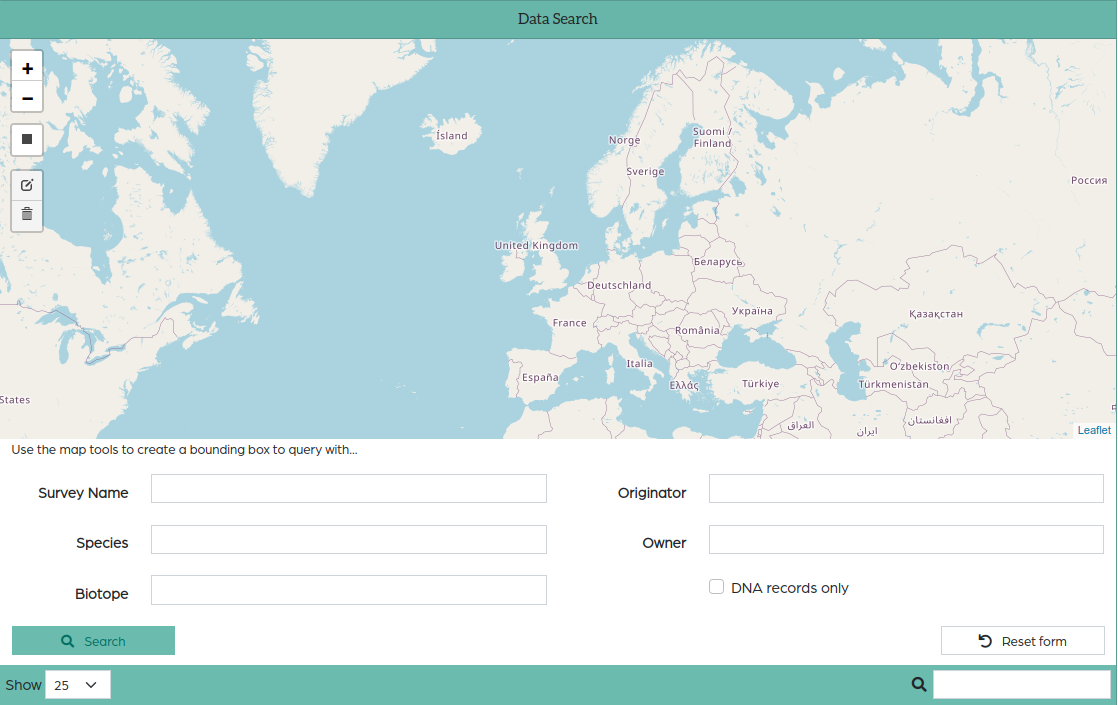
DASSH Mapper
The DASSH Mapper is an interactive map that allows you to search, view and download species and biotope records held by DASSH. You can search by survey name, species, biotope, originator, owner, and can filter by location and whether they’re DNA records.
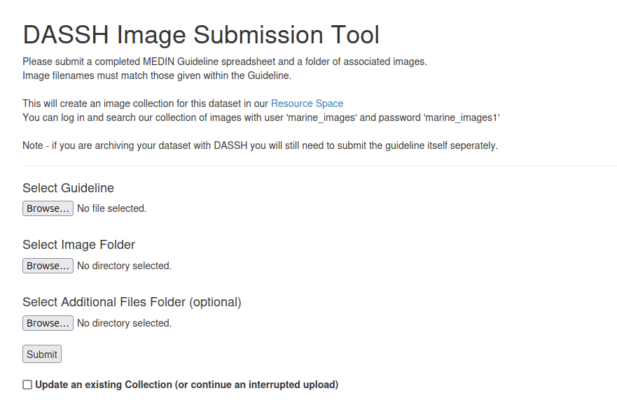
DASSH Image Submission Tool
This tool allows users to upload and submit images of marine species and habitats for archiving and integration into marine biodiversity datasets. It streamlines the process of contributing visual data to the DASSH archive, enhancing data quality and supporting research on species identification and habitat mapping. Users upload images through a user-friendly interface, attach relevant metadata, and submit them for validation and archiving.
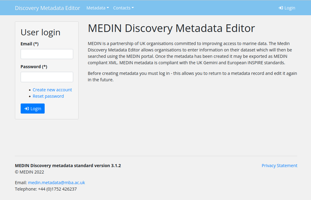
MEDIN Metadata Editor
Discovery metadata is a list of information that accompanies a data set and allows other people to find out what the data set contains, where it was collected and how they can get hold of it.
MEDIN have produced a standard for marine metadata and a set of tools to create metadata records that comply with the MEDIN Metadata Standard.
You can create, validate and publish your metadata using the MEDIN Metadata Editor.
If you need support you can contact the MEDIN helpdesk medin.metadata@mba.ac.uk
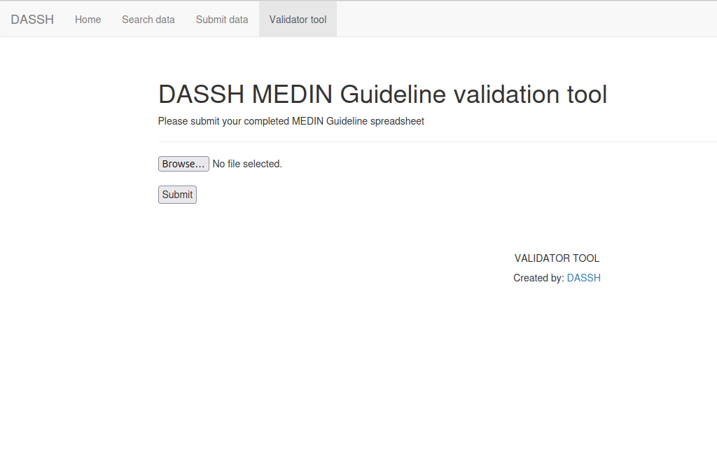
MEDIN Guideline Validation Tool
This tool validates marine datasets to ensure they comply with the MEDIN Data Guidelines, which set standards for marine environmental data. It helps data providers maintain high-quality, standardized datasets, ensuring compatibility with national and international marine data systems. Users upload their datasets, and the tool checks them against MEDIN standards, providing feedback and guidance for corrections if necessary.
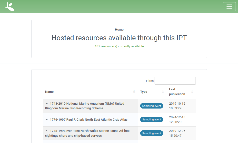
DASSH IPT (Integrated Publishing Toolkit)
The DASSH IPT enables the publication and sharing of marine biodiversity datasets through global biodiversity networks like GBIF. It simplifies the process of making marine data publicly accessible, promoting collaboration and enhancing research by linking local datasets to global biodiversity platforms. Users can upload and format datasets for publication, ensuring compliance with metadata standards and facilitating integration into biodiversity repositories.
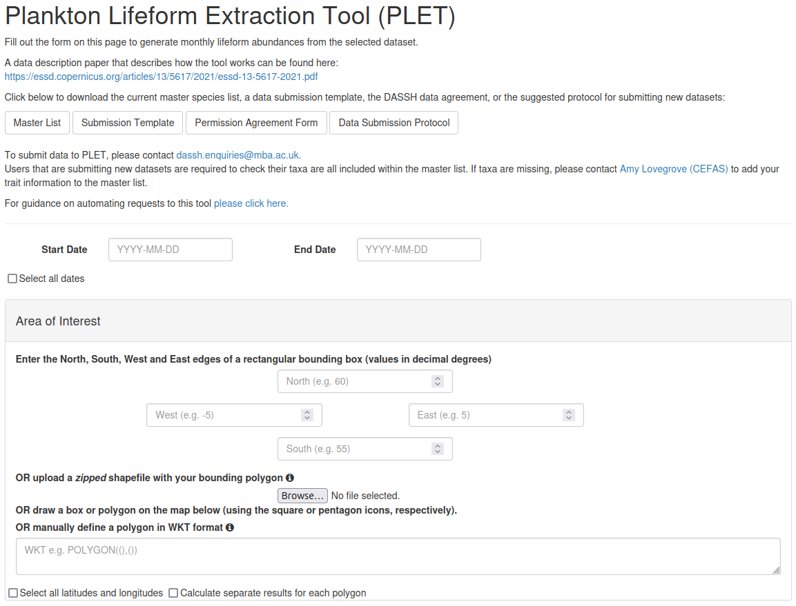
Plankton Lifeform Extraction Tool
PLET
This tool classifies plankton data into functional lifeform categories based on ecological traits. It transforms complex plankton datasets into actionable insights, helping researchers study ecosystem dynamics, track environmental changes, and support marine conservation. Users input plankton data, and the tool applies trait-based algorithms to group species into lifeforms, with options for visualization and reporting.
CPR Planktag Upload
The CPR Planktag Upload tool facilitates the submission of Continuous Plankton Recorder (CPR) data for processing and archiving. It ensures consistent and efficient submission of CPR data, which is vital for long-term monitoring of plankton populations and marine ecosystem health. Users upload CPR datasets in standardized formats, which are validated and stored for use in research and environmental assessments.
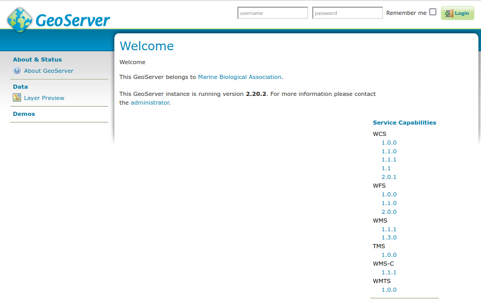
DASSH GeoServer
The DASSH GeoServer serves marine and coastal spatial data through web-based mapping services, enabling access to geospatial datasets related to seabed habitats and species. It provides researchers, policymakers, and conservationists with easy-to-use tools to visualize, analyze, and share geospatial data critical for marine planning and biodiversity conservation. Users can access datasets via standard web services, integrate them with GIS tools, and explore data interactively through web maps.